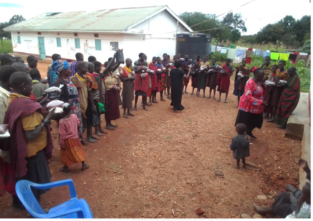
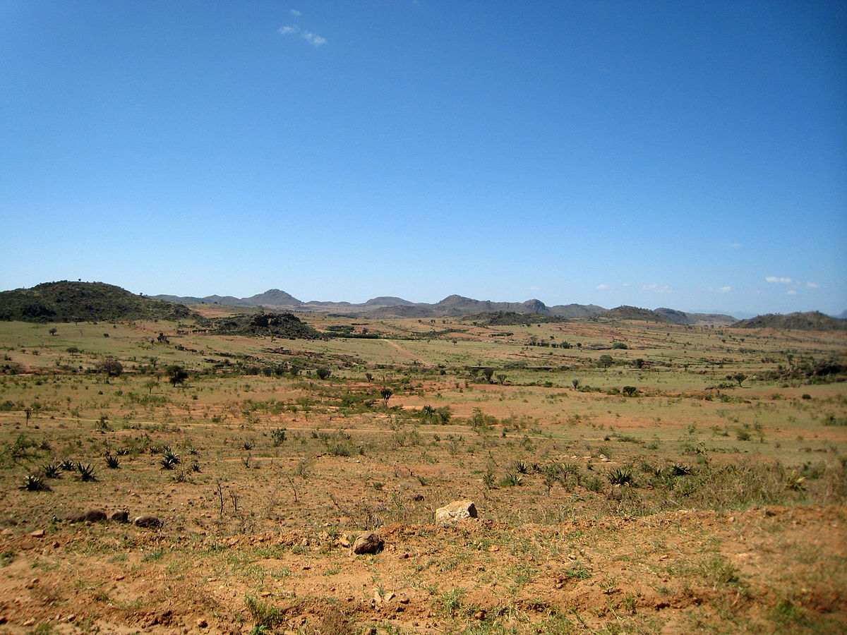
The Region, stretches across an isolated corner of Africa named after the people who have there lived for centuries, the Karimojong of Karamoja. With more than 27,000 square kilometres, this arid I expanse of savannah and bush forms the northeast edge of Uganda where it borders Kenya and the Sudan, with Ethiopia not far off. Countries and boundaries, however, have meant little in Karamoja until recent times. Its natural borders alone tell something about the region’s remoteness. To its east stands the Rift Valley escarpment towering over the Kenyan plains and scrubland. To the north lie the pristine basin of Kidepo National Park and also a mountainous vastness that leads into the Sudan. Similarly, to the south, there are the rugged peaks of Mount Elgon National Park, which were formed by volcanic eruptions millions of years ago. In the west, abundant swamps lead to Acholi lands. Set on a large plateau, much of Karamoja is more than 1,000 metres above sea level, and four main mountains overlook the region’s savannah, highlands and river valleys: Mount Morungole in the north, Mount Moroto in the east, Mount Kadam in the south and Mount Napak in the west.
According to the most recent Ugandan census figures, some 956,000 people live in Karamoja, with more than a third of them being Karimojong. The actual numbers, however, are estimated to be higher. With Moroto town as its regional capital.
Karamoja has Seven districts — Moroto, Kotido, Kaabong , Nakapiripirit, Abim Amudat and Napak District towns have a degree of population density, but pastoral life as well as the scarcity of rain, keeps people on the move and well dispersed.
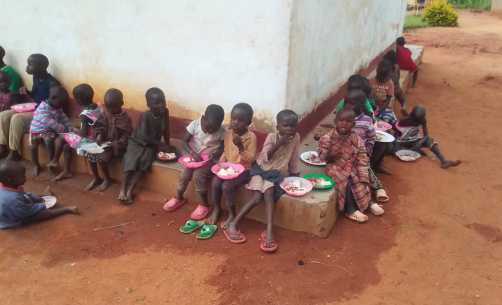
SCHOOLS IN KARAMOJA.
The number of schools per district keeps growing as needs require. Currently Abim has 48 , Amudat 19, Kaabong 71, Kotido 43, Moroto 63, Nakapiripirit 62, Napaak 63 and Nabilatuk 29 schools.
Moroto District
It is part of the former Karamoja District which existed at Independence in1962. Under the 1974 provincial Administration, the district was divided into 3 North Karamoja, Central Karamoja and South Karamoja. IN 1980, Central and South Karamoja were joined to form one district and renamed Moroto. IN 2001, Chekwii County was separated from Moroto District and became Nakapiripirit District.
LOCATION
It borders the district of Nakapiripirit in the south, Katakwi in the south-west, Kotido in the north and the republic of Kenya in the east.
POPULATION
170,506 people, 89,568 female, 80,938 males.
MAIN LANGUAGE;
Ng’akarimojong and Kiswahili.
ECONOMIC ACTIVITIES
Mainly Cattle rearing and Subsistence agriculture with emphasis on food crops such as Sorghum, maize, finger millet, pigeons, Pease, g-nuts, sunflower, sweet potatoes and beans. Vegetables like cabbage and cattle rearing.
Kotido District
At Independence in 1962, Karamoja consisted of the present day Kotido, Moroto and Nakapiripirit. Under the 1974 Provincial Administration, the district was divided into North Karamoja, South Karamoja and Central Karamoja. In 1980, North Karamoja became Kotido District. It is part of the former Karamoja District.
LOCATION
It borders the districts of Kitgum in the west, Moroto in the south, the republic of Kenya in the east and Sudan in the north.
POPULATION
596,130 people, 298,640 female, 297,490male.
MAIN LANGUAGE;
Ng’akarimojong.
ECONOMIC ACTIVITIES
Cattle rearing under pastoralism in the main economic activity. Food crops include Sorghum, maize, finger millet, pigeons, Pease, g-nuts, sunflower, sweet potatoes and beans.
Kaabong District
Location
Kaabong District is bordered by South Sudan to the northwest, Kenya to the northeast and the east, Moroto District to the southeast, Kotido District to the south, and Kitgum District to the west. The district headquarters at Kaabong, are approximately 155 kilometres (96 mi), by road, northwest of Moroto, the largest town in the sub-region.
Kaabong District became functional on 1 July 2005. Prior to that, it was known as Dodoth County in Kotido District. The district is part of the Karamoja sub-region, home to an estimated 1.2 million Karimojong.
Kaabong has two counties: Dodoth East County and Dodoth West County.This is divided into one town council, Kaabong, and thirteen sub-counties: Karenga, Lobalangit, Kawalakol, Kapedo, Lolelia, Lodiko, Kathile, Sidok, Kalapata, Kamion, Kaabong East, Kaabong West and Loyoro.
Population
395,200.
Abim District

Abim is a town of Abim district in Karamoja , the North Easturn Region of Uganda East Africa . It is the chief municipal, administrative, and commercial center of Abim District.
Location
Abim lies in Abim District, Karamoja sub-region, Northern Uganda. It is located approximately 140 kilometres (87 mi), by road, northwest of Moroto, the largest town in the sub-region. This location lies approximately 360 kilometres (220 mi), by road, northeast of Kampala, the capital of Uganda and the largest city in that country.The coordinates of the town are:2°42’07.2″N 33°39’36.0″E (Latitude:2.7020; Longitude:33.6600).
Population in Abim
According to the 1st July 2017 estimates ,population census , Abim district population is 127,600 thousand people as Uganda is estimated at 37,673, 800 million people . The females in Abim form 48.6% and males form 51.4% , whereas the population in rural areas is 84.1% while only 15.9% live in urban areas.
ADMISTRATIVE STRUCTURES.
Abim has six subcounties namely Abim , Alerek, Abim Town Council, Lotukei, Morulem and Nyakwae subcounties. The number of parishes are 34 and 306 villages.
SCHOOLS IN ABIM DISTRICT.
There are over 48 schools with three nursery schools, 40 primary schools , four secondary schools and one Btvet.
Nakapiripirt District
Nakapiripirit District is a district in Northern Uganda. Like many other Ugandan districts, it is named after its ‘chief town’, Nakapiripirit, where the district headquarters are located.
Location
The district is bordered by Napak District to the north, Moroto District to the northeast, Amudat District to the east, Kween District to the southeast, Bulambuli District to the southwest, Kumi District to the west and Katakwi District to the northwest Nakapiripirit, the main municipal, administrative and commercial center in the district, lies approximately 125 kilometres (78 mi), by road, northeast of Mbale, the nearest large town.This location lies approximately 360 kilometres (220 mi), by road, northeast of Kampala, the capital of Uganda and the largest city in that country. The coordinates of the district are:01 55N, 34 40E.
Population
161,600.
Ethnicities
The majority of the population are Karamojong and the language spoken is the Karamojong language.
Economic activity
The main activity in the district is animal husbandry and the majority of the population are pastoralists. However in some areas, especially in the south, some agricultural activity takes place. More recently the exploration of the rich mineral landscape has begun in earnest by American, Canadian, Middle Eastern and Indian prospectors.
Napak District
Napak District is a district in Northern Uganda. It is named after Mount Napak, and its headquarters is at Lokitede.
Location
Napak District is located in the Karamoja sub-region, Northeastern Uganda. It is bordered by Abim District to the northwest, Kotido District to the north, Moroto District to the northeast and east, Nakapiripirit District to the southeast, Katakwi District to the south, Amuria District to the southwest and Otuke District to the west. The district headquarters at Napak are located approximately 80 kilometres (50 mi), by road, southwest of Moroto, the largest town in the sub-region.This location lies about 340 kilometres (210 mi), by road, northeast of Kampala, the capital of Uganda and the largest city in that country. The district coordinates are:02 12N, 34 18E.
Population
197,700.
Amudat District
Amudat is a town in Northern Uganda. It is the main municipal, administrative and commercial center of Amudat District and the district headquarters are located there. The district is named after the town.
Location
Amudat is located in Amudat District, Karamoja sub-region, in Northern Uganda. It lies approximately 85 kilometres (53 mi), by road, southeast of Moroto, the largest town in the sub-region. This location is approximately 400 kilometres (250 mi), by road, northeast of Kampala, the largest city in Uganda, and the capital of that country. The coordinates of the town are:01 57 00N, 34 57 00E (Latitude:1°57’08.0″N, 34°56’40.0″E (Latitude:1.952223; Longitude:34.944445).
Overview
Amudat was selected to be the headquarters of the newly established Amudat District, which was created by Act of Parliament and began functioning on 1 July 2010. The town is the most eastward of all the 111 district capitals in Uganda.
Population
As of January 2011, it was estimated that the population of Amudat was about 1,900.